Here the faux map of Zena Halpern. They wanted me to do a show. Trump is sending s fleet to Iran and blessed a dictator.
Stay tuned.
Halpern’s map of Oak Island
Zena’s map has made a lot of noise on The Curse of Oak Island (COOI) so far. Its authenticity has been debated both on the show and in fan communities. It has guided part of the work done by the COOI team. Today I’d like to take a good, close, long overdue look at it.

Zena’s map
My first impression is that if there is an original somewhere, and if that original is old, this is a very recent copy of it. The script is modern. For contrast, here is an example of 18th Century French script, and anyone who has been following the show has seen other examples.
Zena’s document is mostly block letters with what I would call semi-cursive mixed in. The S and the T are fully modern. This is not an old document in its current form.
It’s also clear to me that whoever made it is not Francophone, and probably not terribly familiar with French. There are very basic errors and oddities that can’t be ascribed simply to archaic language. I will note when there are linguistic features that could be archaic, and when archaic features should be there and are missing.

The COOI Team’s translation
Starting in the top right corner of the full map, we have “cette dessan”, which is probably intended to mean “ce dessein” (this drawing). “Dessein” takes the masculine article “ce”, and not the feminine “cette.” The word “dessan” seems to be a phonetic rendering of “dessein”, if you pronounce it with a modern Parisian accent. It would be rendered differently with a Quebec accent, for example.
“Dessein” is a strange choice here. There are many better options, such as “carte” or “plan” (both for map, or “croquis” (sketch). You would normally use “dessein” if you were drawing a flower or something, but not a map.
Anything after “Rochefoucauld” is difficult to read and interpret, and looks like nonsense. It could be something like “un peu verre d’appre nous (something)”, which could stand for “a little toward (something) according to us”, except that toward should be “vers”, and not “verre” (which means glass), and “d’appre” should be “d’après.” Anyway, I won’t spend more time on this fragment. If someone has an idea. Let me know.
The compass rose is definitely odd. It puts the west at the top, which is quite rare. Old maps are much more likely to be oriented either north, like modern ones, or east, which is where the expression “to orient a map” comes from (i.e. orient = east).
The compass rose also shows “le bateau” (the boat, as opposed to “navire”, which would be a ship), and “le barque” (the barque, a common type of boat), except that “barque” takes the feminine article “la”, rather than “le.”
Below that we have “le atterissage”, intended to mean “the landing”, but “attérissage” takes the feminine article “la”, which would be abbreviated to L and an apostrophe (“l’attérissage”), because French doesn’t tolerate consecutive vowels in an article-noun group. This is a very basic rule in French and suggests that whoever did the map did not know French very well. “Attérissage” also takes an accent on the e.
This is followed by the date “un mille trois cent quarante-sept”, meaning “one thousand three hundred forty-seven”, except that in French, whether modern or archaic, the “one” (“un”) in “one thousand” would be dropped entirely. This should simply read “mille trois cent quarante-sept.”
To the left of that, we have “Ne vous allez ici avec le bateau”, which is likely intended to mean “Don’t go there with the boat”, and should read “N’allez pas ici avec le bateau.” The meaning is plain, but the grammar is very tortured. Interestingly, if this was really in archaic French, the “pas” would likely be replaced by “point.”
At the very bottom, we have a cryptic note that “Les sud indiens travaille tres bon”, probably intended to mean “The indians to the South (referring to indigenous people) work very well”, and in that case should read “Les indiens au sud (or du sud) travaillent très bien.” The verb ending is third person singular instead of plural, but I can let that go. The literal translation of what’s written here would be something like “the south indians work very good.”
This is followed by “le lionceau de Talmont”, or “the lion cub of Talmont.” Talmont is a castle in France associated with Richard Lionheart.
Now we get to the representation of the island itself, and the landmarks noted on it.
Just above the island, we have what is pretty clearly “La anse”, which in geographical context is a small bay. Again, the article’s vowel should be dropped and replaced with an apostrophe, so this should be “L’anse”, similar to L’Anse aux Meadows in Newfoundland, where there is a Viking archaeological site.
On the translated map shown on COOI, “La anse” is read as “La ange” and translated to “The angel.” In French, however, angel takes the masculine article “le”, rather than the feminine “la”, and anyway, it would still be “L’ange.”
Then we have “le trou sous la trappe”, which is translated on the show as “the hole under the hatch.” This is defensible. “La trappe” could be more directly translated as a trap, as in for animals, but it can also be a hatchlike door.
To the left of this is “les isle des chene”, translated by the team as “Oak Island.” There are a number of problems here. First, the article “les” is plural, indicating a group of islands, rather than a single one, but the work “isle” is still singular. Like in English, it would take an “s” in the plural.
“Isle” is the archaic form of the modern French word for Island, but again it is missing its accent on the “i”. Then we have the “chene” (oak), which is missing its accent (should be “chêne”) and should also be plural, since it is preceded by the plural “des”, rather than the singular “du”.
In modern French, Oak Island would be either “L’Île du Chêne” or “L’ïle des Chênes.” On an old map, however, I would expect the archaic forms of both words, giving us “L’Îsle des Chêsnes.”
Moving to the left a bit, we have “la soupape”, accurately translated by the team as “the valve”, and then “le triangle”, followed by a word that could be “deca”, but I don’t know what to make of it. The COOI team seems to think it is an abbreviation for December, making the whole thing “the December triangle.” It looks doubtful to me, and “dec” as an abbreviation for December should still have an accent on the e (“déc”).
Moving down the island, we have “le marais”, uncontroversially rendered as “the marsh”, “le basin” as “the basin”, and “le barrage” as “the dam.”
“La ancres” as “the anchors” is a bit more problematic, simply because “la” indicates a singular, and “ancres” is plural, and we have the two consecutive vowels again, rather than the apostrophe. So it should either be “l’ancre” (singular), or “les ancres” (plural).
“Le triangle de Pierre” as “the stone triangle” presents a bit of a puzzle. Normally in French, the stones in a stone triangle or a stone circle would be plural, as in “le triangle de pierres” (note the “s” on pierres. On the other hand, the “P” on Pierre seems to be upper case, which could indicate the name of a person, as in Peter’s triangle, in which case it would be singular and not plural. Make of that what you will.
Going around the point of the island, we find “le chene entrer ici”, translated by the COOI team as “the oak enter here.” I mean, generally yes, but it is bad and confusing French grammar. “Le chene” is the oak, minus the accent on the e (again), and in it’s modern instead of archaic form, but “entrer” is the infinitive form of the verb.
If it was an instruction, it would normally take the imperative form (“entrez”), and if it was a description (i.e. an entrance), it would take the noun form (entrée). Still, it is an easy enough error to make, and some Francophones would make it too.
Finally, we have “la voute en bas de terre”, which is very confusing, and is translated by the team as the no less confusing “the earth vaulted bay.” I think whoever wrote this was trying to say “the underground vault”, which would then be “la voûte souterraine”, or at the very least “la voûte sous terre.”
The literal translation of the phrase is “the vault below earth”, but no one would say it that way in French. It reads like a very literally translated English phrase. And there is that missing accent again, as if the person who made the map had never heard of all the diacritics we liberally sprinkle over French words to indicate different sounds.
In summary, I would say every indication is that the map is recent, and was made by someone with no more than passing familiarity with the French language.
Share this:
Related
Oak Island archaeology update: Gun stones and rose goldNovember 30, 2021Liked by 3 people
Oak Island Archaeology Update: Have they found FDR’s rubber boot?March 7, 2022In “Oak Island”
Oak Island Archaeology Update: An actual, accurate translation of the letter from the commander of the Castor and the AuroreDecember 19, 2022In “Pseudo-archaeology”Posted in Uncategorized
Post navigation
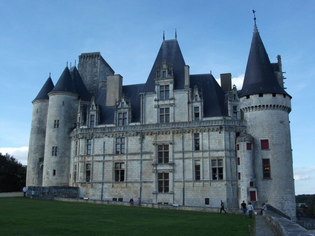
The narrator then informs us of the castle’s history, saying: “Chateau de La Rochefoucauld began as a large wooden fortification built in the year 980 as a means of protecting its inhabitants from Viking invaders. Over the next 500 years, it would continue to grow in size, and is now considered one of the greatest achievements of the French Renaissance.”
Later, Rick Lagina presents Sonia Matossian with one of Zena Halpern’s maps, in the top right-hand corner of which are written the words, “Cette dessun pour M. Francois de Rochefaucauld, un petite verre d’appre Neustria,” roughly translated as, “This drawing for M. Francois Rochfoucauld, a little drink learned from Neustria.” After Matossian states that the map obviously has a connection with the La Rochefoucauld family, Rick asks her if her family had any connections with the Knights Templar. “I’ve never heard of Templars in the family,” she replies. “Doesn’t mean that there weren’t any… I have heard of the Crusades. They all went to the Crusades.” Matossian goes on to suggest that it was entirely possible that her La Rochefoucauld ancestors met Templar knights in the Holy Land. The narrator expands on that notion by suggesting that members of the Knights Templar might have entrusted the secret location of their fabled treasure to members of the La Rochefoucauld family.
52 thoughts on “Curse of Oak Island Archaeology Update: A good look at Zena Halpern’s map of Oak Island”
dglea2473says:The map was taken to France to the castle of the Rochefoucould where the family member and caretaker translated to Rick and team the meanings of the old French. Also, they were taken down to the dungeons (?) to see the carvings in the walls and one that matched the cross that they found. It was an interesting show. The map they carry around isn’t the original from the book zena found it in. She left everything to Rick and OAK IDLAND. DebLikeReply
St Guinefortsays:Hi, I have followed the program for a few seasons. Something does lie buried on Oak Island of quite a significance. Who would endeavour such an extended tunnel system with complex traps for anything but a serious reason? The recent data show something of extreme value was indeed buried long ago on the Island.However, shows of this nature must keep the viewer wanting more. For this reason, many extrapolations concerning the ‘treasure’s’ origin were used, possibly in some case for program padding.In 2001, I visited Rosslyn chapel. It leaves no doubt someone visited North America prior to 1492. And on the right side of the altar, there’s a recess where a tomb identified as a crusader one (preceding the chapel itself) hints at a Templar connection. The Scots certainly must have heard of the land to the West from settlers of Viking origin.Zena Halpern’s book resembles in some way (my opinion) a mixture of mainly facts plus a number of dubious additions, for instance, the island map already discussed. At best, I suspect it’s a recent creation based on an oral transmission retained by a past Francophone family who moved to New England more than a century ago. At worst, it’s a red herring. Here’s where Zena’s text would never have passed peer review apart from the topic itself.The coming season should answer all the questions unless, the loot disappeared quite a while ago. The Freemason connection (along with a member of the team) points to pre-knowledge of the island’s mystery to a degree. Some buried resources financed the American Revolution. However, it seems something else (they do not truly know its nature hints of it, including its precise location) was deposited prior to the XVIII century resources withdrawal.LikeReply
Andre Costopoulos says:It wouldn’t be surprising that stories of Vinland circulated in medieval Scotland, given its close connection with the Viking dispersal. That doesn’t mean medieval Scots visited North America. There is currently no archaeological evidence that they did.As for the tunnels on Oak Island, they can most parsimoniously be explained as the result of searcher activity, at least until solid evidence of older tunnels emerges.Liked by 1 person
2. an inaccessible location, unknown, except for very few
3. the project (construction) achieved on site in total secrecyLikeMitchell Adler says:You are correct. During the crusades many religious artifacts were collected and when they were persecuted the treasure was hidden on the island. The depositors left Megalithic stones with a cipher to recover the artifacts. I discovered a data cache in the stone Triangle and it has since been titles Adler’s Pyramid.A 3 sided pyramid has 720 internal angles and its first external angle of 147 adds up to 867. On and on the Pyramid describes the cross and the angles used to triangulate depth. https://www.facebook.com/photo/?fbid=10233480448499280&set=a.10227930018341995Like
Ramiro Valdez says:He who knows how to read a Templar cipher map, knows the location of the treasure? A cipher map is a secure way of saying that you have a treasure and the only way to locate it is to read the cipher map? A Templar who has had training in ciphering is going to have a tough time deciphering another Templar’s map. Each Templar who decides to create a symbolic cipher map is going to created it based on his knowledge of the area he selects which is usually unknown to those who want his treasure. Therefore it is not easy to decipher a map that was not of your creation. You can if you have the skill and knowledge, but it’s going to take a little bit of time and hard work? Which is something that you might not want to do? Think about all the time and hard work spent by treasure hunters on Oak Island looking for the treasure. The Templar will complete his cipher map with the help of those that he can trust and have been sworn to secrecy. All ciphers are different and will require hard work in order to locate the treasure, but not impossible. With today’s technology one is capable of reviving the pirate from his grave enter his mind and unlock the secret that he holds? Ciphers that are found inscribed in stone are there for a reason. It is a simple one to understand and only those who are skilled know why? If you know the answer to that, then you know the reason why someone has to reproduce the map as many times as needed and the reason why the Templars were never afraid if you found it. You now have their ciphers in your hand and you still don’t know how to read them! That is a point well made? Ciphers are amazing when you figure them out! So let’s not worry about how many times a cipher has be redrawn, but do question if the cipher is original? The three cipher maps that were original present to Rick and not the one that Zena explain or wrote on, are true cipher maps possibly copies of the original maps. But that won’t matter because the map do carry the information you need? Could you imagine why? The church sold a Templar’s journal plus a 12 century cipher map for a hand full of dollars? Badly needed information was taken out of the journal and the cipher map was no longer needed because it only detailed the location of Oak island which was not going to help the French locate the treasure? But, the 15 century cipher map is different and you need to know how to read it? Or you need to ask someone who could read it so you don’t drill to many holes? They are not ready to ask or they would if asked me? So the drilling must go on! Let’s just talk about the 12 century navigational cipher map, a little. If you know this map, then follow along with your map. The two most important things on the cipher map is a sharp pointed hook and a small island. The two will collaborate with each other in defining Oak Island as the final destination. Find a map of Oak Island on your computer using satellite imaging and locate a small circular island south of Oak Island. Match to size and align the small circular island found on the cipher map to the map on your computer so you can see clearly what the hook is pointing to. When aligning the small tail of the small island the hook’s point will describe to you what your looking for. I can describe the whole map, but I think that it’s, too much, to easy, for those that want to learn for themselves? Oliver Levasseur’s Le Formule cipher map talks about another treasure that is not found on Oak IslandLikeReply
Ramiro Valdez says:HelloLikeReply
bruce falinksays:I find the whole treasure thing intriguing. Especially considering it has been around for so long and involved so many people. I also understand the skepticism outlined on this site. I understand the difficulties in this adventure. But there is one question that no one has dealt with on this site- All the lumber they have found underground. The lumber that has been found to be “old”. Why is this lumber so far underground and deeper than the searchers have ever gone? It leads me to believe there is some reason for this and what is it. This may be a fools gold errand- but to find the answers to the questions may be in and of itself a “found” treasure.LikeReply
Joe Scalessays:In regard to the aged wood, the show would like you to think that there was nothing happening on Oak Island until the treasure hoax began (allegedly in 1795, but actually in 1849). They’ve been digging up that island for over 170 years, then burying it back again and again and again. Considering that people actually did live on that island in the 18th century and had been there for some time prior, it would not be out of the ordinary for old works from unrelated projects to be dug up and deposited with the rest of the material from fruitless searches over the years. Remember when they dug up the beach and found a bulkhead? Well, they didn’t call it that, but instead made it some sort of mystery out of it as if a bulkhead on a waterfront isn’t an every day sort of thing. And this all assumes that their carbon dating is accurate and uncontaminated… which given their past overwhelming mendacity in other concerns, has me skeptical of same.As for the map, the more interesting history in its regard is the ongoing war between fringe forces competing for this bit of tripe. I kid you not:http://scottwolteranswers.blogspot.com/2018/12/the-truth-about-oak-island-and-cremona.htmlLiked by 1 personReply
adamlesh says:Shortly after I clicked the link you helpfully embedded, my five-year-old began expounding on a Rube Goldberg machine he was building in the living room. His chain of logic and his understanding of cause and effect was a remarkably appropriate primer for the credulity required to investigate the claims made at the blog you linked to, and at the many other sites I visited to understand its claims and the general context for Halpern’s so-called map.So, I thank you for your comment, and other equally incisive ones you’ve made here on Dr. Costopolous’s blog. I can’t say that I thought much of the map or of any of the show’s fanciful theories, but you’ve saved me much effort should I ever have sought to explain why.It gave me an idea for a t-shirt slogan: “Real archaeologists don’t go down rabbit holes. They dig their own.”However, to be fair to rabbits, I’m sure they’ve inadvertently contributed more to archaeology than Templar theorists ever will.Like
Othelo says:Not french, but deca (δέκα) in Greek is a numeral indicator, and has been used outside the Greek language, no?LikeReply
Pascal says:As a french speaker I’m almost certain it says “Le triangle de ça” loosely meant to mean “That triangle”. Like it has been pointed out, it is not a good french translation. Maybe it is meant to say Nolan’s cross. Just guessing here.I’m trying very hard to imagine why a non french speaker would try to translate a map in any other language. But this map definitively is about Oak Island because besides its distinct elephant shape there arr many items on the map that have actual known counterpart on the island itself.About the date 1347. We saw that date inscribed in the well in Portugal. 1347 is the year of the Plague. We should not be surprised to see that particular date appear anywhere in medieval times. Surprised nobody ever mentionned it. Btw Templars were decimated on October 13, 1307. That was 40 years before.LikeReply
ValarieCsays:Your assessment has me thinking of my own chicken scratch (in English) when analyzing a problem or creating visual aids to a theory (say genealogy timelines or property descriptions). My notes are truncated or “short handed”. Perhaps this is a note made by a former “searcher” that was roughly translated into French to send off for review/input. Before internet, earlier researchers would have had to hand copy notes and mail to an expert in some field or another. This would account for the incomplete thoughts and poor translations. My first impression when I saw the earlier episode introducing this map is also in-line with many, that ultimately this is not a copy of an old map. Many features captured were created at different times (per their own dating?)…so the map can only be as early as the last land mark creation. Remember, they believe that originally Oak Island was two islands and the the swamp was filled in to bury something.LikeReply
- Pingback: Breaking Down Zena’s Map From ‘Curse Of Oak Island’ – Bulletin Guide
- Pingback: Breaking Down Zena’s Map From ‘Curse Of Oak Island’ – S.G.E
- Pingback: Breaking Down Zena’s Map From ‘Curse Of Oak Island’ – The Madison Leader Gazette
Bruce says:Has the show ever shown Zena’s original map? Marty and Rick and the team seem to test everything they find. Has anyone tested the map? Analyze the paper and ink?LikeReply
Denise says:Excluding the script/hand of the lettering, when I think about the half-literates walking around these days, I wonder if it’s not possible that the writing was done by someone for whom French was not their first language, by someone who was uneducated about or never learned formal spelling and grammar, etc. Also, I knew a guy with a bachelor’s degree who spelled “sausage” as “sokag” so formal education doesn’t have to equate to perfection. I’m no fan of the map but does it have to have been created by someone who had an excellent grasp of spelling, grammar, etc?LikeReply
Stevesays:Thanks to the OP for a clear and concise interpretation of the pigeon French used on the map.The map is drawn by William (Bill) Jackson (1970’s), as are Cremona document maps and La Formule. La Formule is also connected to Oak Island by the same Zena Halpern, as I understand it. A simple examination of his handwriting proves this beyond any doubt. Here is a link to my short research. It didn’t really warrant much more.https://drive.google.com/file/d/1a5IAJPFQcwFWJEAMgdHATMZDojhlxSe3/view?usp=share_linkLikeReply
Last part concerns Scottish Chain measurements. I have been doing the SC measurements on the two well’s they have recently found.
North one has 16 SC hits to our locations.
South one has at least 9 SC hits, (to be honest I gave up so there may be more).
Could all be coincidence of course
SteveLikeReplyRich Rowansays:The line “un mille trois cent quarante-sept” is a distance not a date, and would likely be in pied rather than feet. 1347 pied would be 1436 feet. There isn’t anything on the map that claims it is a date.Oak Island Research channel on YouTube makes a pretty compelling argument that a lot of the oddities of language are because it may be using a lot of French homophones and other wordplay to encode information.LikeReply
Any comments on my theory?LikeReply
Splash says:I believe there is pirate treasure, theres so many finds dated in good order to indicate pirates and the various officers artifacts, ship parts and finds of military significance from multiple countries indicates plunder to meLikeReply
Antonio Tremblay says:It was quickly draw with no real professionalism in it. I would expect something more precise with french accents. On the top right I read “Ce dessin pour M Delarochefoucault, un pervers selon nous là” which says that Delarochefaoucault is a pervert”.. This doc was not created by a french speaking person, but by an english speaking person, who had a very lousy translator or dictionary.. A crook, basically…LikeReply
Ramiro Valdezsays:If you know how to read cipher maps you would understand what is happening and what the outcome will be? They will find many old historical items belonging to those that once occupied the island but the treasure is the most important thing and the main focus of their adventure. Looking for more historical items to locate the treasure is not necessary and if found these items will not help them locate the treasure. Everything needed to locate the treasure has been given to them and they have no clue? So therefore they will find nothing pertaining to the treasure. They will drag this as many years as they can or want. The only thing holding them back is the water well. When they get to the bottom of it they’ll figure it out? The end of their campaign will come to a standstill. Their worst nightmare is the end, the end without an end! Why? Well, like I said before if you don’t know, then ask somebody that knows! There is an old Mexican saying “ He who knows more is worth more “. This can be true. I know a lot about cipher maps therefore I could possibly be the one. Try me, I’m good for it!!!!LikeReply
S says:Dear AndreThanks so much for your wonderful blog!With respect to Zena Halpern’s map, here’s my interpretation:1. While I don’t think this necessarily a “real treasure map,” nor do I think it’s a “forgery” or “fake treasure map.” If someone wanted to create a fake, they could have easily made it much more believable.2. I agree with you it seems to be written by someone who is clearly not an educated speaker of French, and that it appears to be of relatively recent origin (1700s? 1800s? 1900s? – I don’t know enough about the history of French Canada to narrow it down).3. To me it seems to be a real communication (or a copy of a real communication) from a relatively uneducated person having some familiarity with French, addressed to a French speaker of the monied class located in Europe.a. Based on context clues, the writer (Le Lionceau de Talmont) could be someone serving as an overseer of, or translator/liaison between, a French landowner/slaveowner (“M. Francois La Rochefoucauld”) and his properties including “Indians” in French Canada.
b. The writer could be an Indigenous person who has converted to Christianity (hence his taking pains to include a Christian fish next to his name).
c. The writer could have gained some minimal knowledge of French, along with an affectionate nickname (“Le Lionceau”), while on a trip to France or during a stint in a French Canadian institution of some sort (a mission?).
d. The “Indians of the South” could refer to Indigenous persons, or perhaps African Americans or mixed-race persons, transported to French Canada from parts south (Louisiana? West Indies?) to work for M. La Rochefoucauld (MLR), perhaps under the direction of Le Lionceau.
e. “Un petite verre d’apprenoust (?) la ouest” (sic) I interpret as “a little window [verre = glass = window] so we [or “you”] can learn about [apprenoust = garbled, could have meant “apprenons nous” or “apprenez vous”] the [situation in the] west [i.e. French Canada].”
f. The references to “landing,” a distance of “1347,” and “don’t go here with the boat” I interpret as providing guidance for an upcoming planned trip by MLR to visit the area.4. The various features noted on the island could represent Le Lionceau’s attempt to communicate to MLR where to find these features when he comes to the island to see them for himself.a. Whether or not each of *us* does or does not believe in the veracity of the legends surrounding Oak Island, it is certainly the case that *some* people believe them now and have believed them in the past.
b. MLR may be someone who believed in these legends, or at least was curious about them.
c. Based on his name, MLR may have been the recipient of specific knowledge about features of the island handed down through his family. Alternately, he may have merely heard rumors about the island and asked Le Lionceau to investigate.
d. Le Lionceau could have visited the island and noted the location of features that would interest MLR, either by merely observing and noting curious features on the island or else by attempting to correlate a list of items provided by MLR to observable features on the island. MLR could have even provided an older map for reference and asked Le Lionceau to draw an updated map showing the features in relation to the current shape of the island at the time the new drawing was created.This is my interpretation.Thank you very much for providing the fodder for a pleasant afternoon of rumination!LikeReplyGullilaume says:Thank all who have posted here. Your analysis and speculations are quite interesting and plausible. Yet the most accurate comment here is by Ramiro Valdez in his last sentence “…because the treasure is not in the money pit. Good Luck.”LikeReply
- Dangereuse of L’Île-Bouchard (Poitevin: Dangerosa; 1079 – 1151) was the daughter of Bartholomew, Lord of L’Île-Bouchard and his wife Gerberge of Blaison. She was the maternal grandmother of the celebrated Eleanor of Aquitaine. She was also mistress to her granddaughters’ paternal grandfather, William IX, Duke of Aquitaine. As the mistress of William the Troubadour, she was known as La Maubergeonne for the tower he built for her at his castle in Poitiers.
- Dangereuse (“Dangerous”) was a sobriquet she received for her seductiveness; her baptismal name may have been Amauberge or Amal(a)berge.
- Life
- [edit]
- Marriage
- [edit]
- Dangereuse married Aimery I, Viscount of Châtellerault, at an unknown date. She advised her husband to donate property to the priory of Saint-Denis-de-Vaux in a charter dated 1109, which means they were married before this point.[1] Dangereuse was a woman who did as she pleased and cared little for the opinion of her peers.[2]
- Their marriage produced five children (two sons and three daughters):
- Hugh (died before 1176) succeeded his father as Viscount
- Raoul de Faye (died 1190) married Elisabeth, dame de Faye-la-Vineuse and had issue; he became grand seneschal of Aquitaine.
- Aénor de Châtellerault (c. 1103 – March 1130) married William X, Duke of Aquitaine, mother to Eleanor of Aquitaine, Petronilla of Aquitaine, and William Aubrey (d. March 1130, age 4)
- Amable, married Wulgrin II of Angoulême
- Aois, married Pierre-Élie de Chauvigny and was the mother of André de Chauvigny.
- Dangereuse and Aimery were married for around seven years before she left her husband to become mistress to Duke William IX; this became an infamous liaison.[3]
- Mistress to William IX
- [edit]
- Whilst travelling through Poitou, Duke William IX of Aquitaine met the “seductive” Dangereuse.[4] This led to her leaving her husband for Duke William, who was excommunicated by the church for “abducting her”; however, she appeared to have been a willing party in the matter. He installed her in the Maubergeonne tower of his castle in Poitiers, and, as related by William of Malmesbury, even painted a picture of her on his shield.[5]
- Upon returning to Poitiers from Toulouse, William’s wife Philippa of Toulouse was enraged to discover a rival woman living in her palace. She appealed to her friends at the court of Aquitaine and to the Church;[6] however, no noble could assist her since William was their feudal overlord, and when the Papal legate Giraud complained to William and told him to return Dangereuse to her husband, William’s only response to the bald legate was, “Curls will grow on your pate before I part with the Viscountess.” Humiliated, in 1116, Philippa chose to retire to the Abbey of Fontevrault.
- Dangereuse and William had three children:
- Henri (died after 1132), a monk and later Prior of Cluny.
- Adelaide (born c. 1102). There is a theory that her mother was Philippa of Toulouse, in which case she was Raoul de Faye, seigneur de Faye-la-Vineuse (Dangereuse and Aimery I‘s second son)’s second wife.
- Sybille, Abbess of Saintes.
- Some[citation needed] believe that Raymond of Poitiers was a child of William by Dangereuse, rather than by Philippa of Toulouse. A primary source which names his mother has not so far been identified. However, he is not named in other sources as a legitimate son of Willam IX. It is therefore reasonable to suppose that he was born from the duke’s relationship with Dangereuse. If this is the case, Dangereuse was grandmother to Bohemund III of Antioch, Maria of Antioch and Philippa of Antioch.
- Philippa died two years later and William’s first wife Ermengarde set out to avenge Philippa. In October 1119, she suddenly appeared at the Council of Reims being held by Pope Calixtus II and demanded that the Pope excommunicate William (again), oust Dangereuse from the ducal palace, and restore herself to her rightful place as duchess. The Pope “declined to accommodate her”; however, she continued to trouble William for several years afterwards. [citation needed]
- The relationship between William IX and his legitimate son William X was troubled by the father’s liaison with Dangereuse. This was only settled when the pair arranged the marriage between William X and Dangereuse’s daughter Aenor in 1121;[7] the following year Eleanor was born.
- William IX died on 10 February 1127; nothing is recorded of Dangereuse after this point. She died in 1151.
Married: 1137 at:
Died: 1 APR 1204 at: Fontevraud Abbey,Maine-et-Loire,France
Spouses: Louis VII the Younger Capet Henry II Curtmantle FitzEmpress
From Wikipedia, the free encyclopedia
| Aimery I, Viscount of Châtellerault | |
 Coat of Arms of Châtellerault Coat of Arms of Châtellerault | |
| Born | c. 1075 |
| Died | 7 November 1151 Notre-Dame de Noyers monastery, in Nouâtre |
| Noble family | Châtellerault |
| Spouse(s) | Dangereuse de l’Isle Bouchard |
| Issue | Hugh de Châtellerault Raoul de Faye Aénor de Châtellerault |
| Father | Boson II de Châtellerault |
| Mother | Aleanor de Thouars |
Aimery I de Châtellerault (c. 1075 – 7 November 1151), was the Viscount of Châtellerault and father of Aenor de Châtellerault. Through his daughter he was the grandfather of Eleanor of Aquitaine, successively queen of France and England.
Family
[edit]
Aimery was born to Boson II de Châtellerault and his wife, Aleanor de Thouars. His paternal grandparents were Hugues I de Châtellerault and his wife, Gerberge. His maternal grandparents were Aimery IV, Viscount of Thouars and Aremgarde de Mauléon.
Life
[edit]
Marriage
[edit]
Aimery was married to Amauberge, called Dangereuse,[1] the daughter of Bartholomew de l’Isle Bouchard and his wife Gerberge de Blaison. Their marriage produced at least three children:
- Hugh, succeeded his father as Viscount of Châtellerault; he was married to Ella d’Alençon daughter of John I, Count of Alençon,[1] and Beatrix of Maine
- Raoul, who became the lord of Fay-la-Vineuse through his marriage to Elisabeth de Faye;[1]
- Aenor (c. 1103 – March 1130), who married William X, Duke of Aquitaine.[1] She was the mother of Duchess Eleanor, Petronilla, and William Aigret, who died at the age of four. Eleanor became Duchess of Aquitaine in her own right, as well as twice being a queen, through successive marriages to Louis VII of France and Henry II of England. Eleanor of Aquitaine was known to have been quite fond of her maternal uncles, Hugh and Raoul, and granted them [clarification needed] during her two tenures as queen of France and then of England.
The affair
[edit]
In 1115, after seven years of marriage, Amauberge was “abducted” from her bedchamber by William IX, Duke of Aquitaine. She was taken to a tower in his castle in Poitiers called Maubergeonne. As a result, Amauberge or Dangereuse was nicknamed La Maubergeonne. Abductions like these were quite common among nobles during the Middle Ages. However, in this particular case she seems to have been a willing contributor to the affair. [citation needed]
The Duke of Aquitaine, the earliest known troubadour whose work survives, was quite popular with the women of his time and was known to have had many affairs. However, the Viscountess would become his mistress for the rest of his life. There is no record of complaint by Aimery. This is believed to be because the Viscount feared the wrath of his powerful and volatile overlord. It would be the Duke’s wife, Philippa of Toulouse who took action against the “abduction” and affair. Her actions would lead to both William and Dangereuse being excommunicated by the Pope. William used his wealth and power to eventually reconcile with the Pope and was accepted back into the Church. [citation needed]
In 1121 Aimery and Dangereuse’s daughter, Aenor, married William IX’s son and heir, who would become Duke William X of Aquitaine. It is believed that this union came about at Dangereuse’s urging, as historians don’t see another reason for the union of such a powerful man to the daughter of a minor vassal. In support of this argument for a domestic rather than a political motive, Aenor was the daughter of the woman the future duke hated for her role in the treatment of his mother. Regardless of the cause, the marriage led to the birth of Eleanor of Aquitaine and made Aimery an ancestor of some of Europe’s most famous nobles and rulers. [citation needed]
Ancestry

.svg)
Leave a comment